You are here
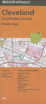
Back to topRand McNally Cleveland/Cuyahoga County, Ohio Street Map (Folded)
Email or call for price
Out of Print
Description
Rand McNally's folded map for Cleveland is a must-have for anyone traveling in and around this part of Ohio, offering unbeatable accuracy and reliability at a great price. Our trusted cartography shows all Interstate, U.S., state, and county highways, along with clearly indicated parks, points of interest, airports, county boundaries, and streets. The easy-to-use legend and detailed index make for quick and easy location of destinations. You'll see why Rand McNally folded maps have been the trusted standard for years.